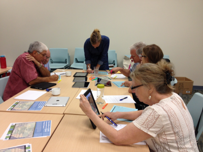
 Workshop participants review results of community sensitivity rankings to natural hazards at the recent workshop. Left to right: Patrick Rios, Felix Keely, Dr. Kiersten Stanzel, Mayor C.J. Wax, Christine Hale, and Barbara Gurtner. Credit: The University of Texas Marine Science Institute. ROCKPORT, Texas – Researchers from the Mission-Aransas Reserve and Texas Sea Grant worked with local community leaders to identify areas within their communities that may be more sensitive to impacts from natural hazards associated with changes to climate. Researchers with the 3-year project hosted a workshop on June 25th at the Bay Education Center in Rockport, Texas to discuss the latest results of the project.
 The purpose of the project is to determine how vulnerable the Mission-Aransas Estuary and surrounding watershed is to changes in climate. The project was designed to look at three aspects of our environment: 1) historical trends in local climate and their effect on fish and bird species, 2) effects of forecasted climate change on local habitats, and 3) the sensitivity of human communities of the Mission-Aransas watershed (Aransas, Bee, Goliad, Refugio, and San Patricio Counties) to the environmental hazards associated with climate change (i.e., more heat waves, relative sea level rise).
In order to determine climate trends and their potential impact on local species, the researchers used existing long-term datasets for climate (temperature, precipitation), birds, and fisheries to determine the relationship between species abundance and climate. The researchers found several important trends. For example, in our local area the number of freeze events or cold spells have decreased in recent decades. There have also been longer dry spells punctuated by intense rain events. In addition researchers looked at the trends in sea level and found that at the Rockport tide station sea level has risen by 5.53 mm per year, on average, for the last approximately 60 years. If sea level continues to rise at this rate, sea level is forecasted to be 7.6 inches higher by 2050. These are examples of a few of the climatic trends studied. The researchers also found significant impacts to fisheries and bird abundance, primarily related to the decreased frequency of freeze events and increased occurrence of droughts.
To determine the effects of forecasted climate change on the natural environment, the researchers are continuing to work with members of the local resource management and research community to assess how vulnerable local habitats may be to climate change impacts. A workshop was held with local stakeholders on November 13, 2014 to determine priority habitats for the assessment. Stakeholders identified marshes, sea grass beds, and oyster reefs as their areas of interest. The project team is currently working with experts to use planning tools to determine the vulnerability of these habitats. Final results on habitat vulnerabilities are expected to be complete this fall.
 Workshop participants discuss adaptation strategies to mitigate effects of natural hazards at the recent workshop. Left to right: Amanda Torres, Rae Mooney, Jace Tunnell and Katie Swanson. Credit: The University of Texas Marine Science Institute. The third objective of the project was to measure how sensitive the human communities of the Mission-Aransas Estuary watershed are to natural hazards, such as hurricanes and climate change. In the recent workshop hosted on June 25th researchers presented the results of a social sensitivity analysis. The researchers used socioeconomic, demographic, and infrastructure data from the U.S. Census, American Community Surveys, and other research publications in their analysis. Variables that were used included such factors as wealth, age structure, housing type, age of homes, tenancy, ethnicity, and many others. The researchers crunched all the data and determined hotspots of sensitivity to environmental hazards such as climate change. The results also identified which factors were important in determining why one area was more sensitive than other areas. The top factors that affected the sensitivity were things such as tenancy (i.e., number of renters, length of residency), reliance on public assistance, age, and proficiency with English. The study found that the most sensitive areas to natural hazards in the watershed included areas within Beeville, Rockport, and Refugio. Workshop participants then delved into the data and discussed what factors made their particular community more sensitive and what measure they could try to take to reduce the impacts of hazards in these sensitive areas. “As a coastal city that relies heavily on our natural resources, we feel that awareness of changes occurring in the climate and to our habitats are important to understand.” said Mayor C.J. Wax. “We are actively developing mitigation and adaptation strategies to protect our valuable community and way of life.” Mayor Wax and other local officials from Rockport and Aransas Pass participated the June workshop.
The goal of the recent workshop and the overall project is to improve the resiliency of local communities and their habitats by strengthening understanding of climate impacts and vulnerability to future climate changes. The final study report will be released in the fall and a draft report can be obtained by contacting Dr. Kiersten Stanzel at This email address is being protected from spambots. You need JavaScript enabled to view it..