Coastal Bend Bays & Estuaries Program (CBBEP) funds a new “Dunescape” in Port Aransas and a Sea-level Monitoring Program in Aransas Bay. Both projects will be implemented and managed by the Mission-Aransas Reserve at The University of Texas Marine Science Institute and total $75,000.
 The new Dunescape will create trails that will enable visitors to see the beauty and importance of sand dunes. The new tail, highlighted in yellow, will be located on The University of Texas Marine Science Institute campus near Cotter Avenue. Credit: The University of Texas Marine Science Institute, original graphic courtesy of Richter Architects.The Dunescape will create a free public walking trail through restored sand dunes with native plant species. The new trail will be located on The University of Texas Marine Science Institute campus near Cotter Avenue and feature interpretive signage that showcases the benefits and importance of dune habitats, such as a wildlife haven and valuable protection from storms. “The sand dunes are often an overlooked resource and we are thrilled that there will be another Port Aransas venue for visitors to view our abundance of birds and wildlife at their finest.” says Ann Vaughan, president and CEO of the Port Aransas Chamber of Commerce. Locals and visitors can expect to see the new public trail open by spring 2017.
The CBBEP will also support an existing sea-level rise monitoring program that the Mission-Aransas Reserve started in 2010. The new influx of funds will be used to help purchase equipment to measure how often the soils get inundated by waters or tides, and if the soil surface is rising or sinking in relation to the adjacent sea water.
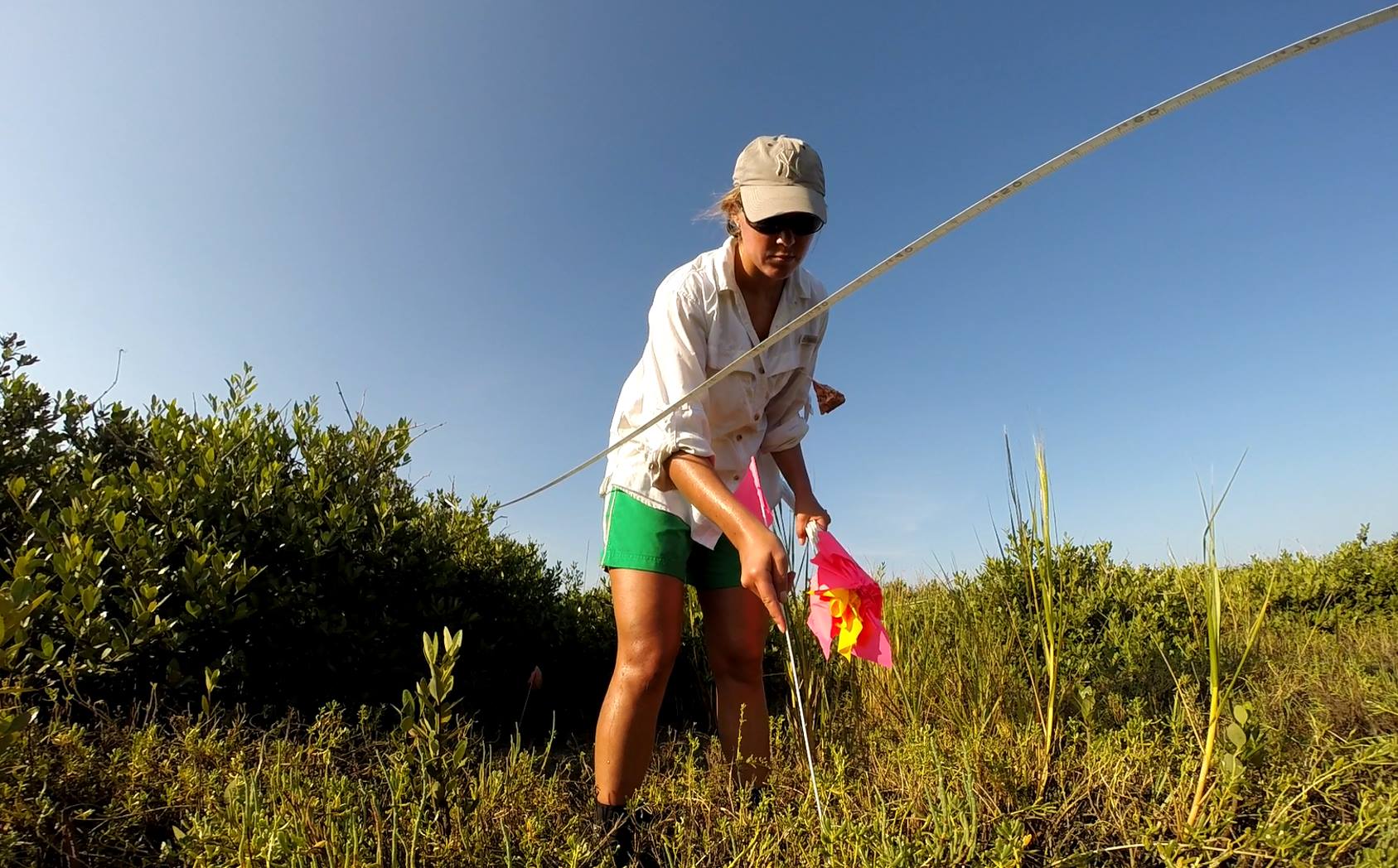 Ecologist Katie Swanson, flags plant communities next to a long measuring tape on Mud Island in Aransas Bay to track how the plants are changing over time. New funding will help purchase equipment to augment this long-term monitoring program. Credit: Jace Tunnell, The University of Texas Marine Science Institute.
The new equipment will augment existing monitoring stations that the Reserve maintains to measure changes in local plant communities. Ecologists at the Reserve will use this information to help determine impacts of sea level change on seagrass, marsh, and mangrove habitats over time. The Sea-level Monitoring Program is strategically placed to provide locally relevant data. “Changes to sea levels can have dramatic impacts to our marshes and communities. The ultimate goal of the program is to supply policy and decision-makers with good data so that informed decisions can be made about our natural environment,” said Reserve ecologist Katie Swanson.
“The Coastal Bend Bays & Estuaries Program is pleased to support these excellent projects that promote our mission to protect and restore the health and productivity of our bays and estuaries while providing public access and educational opportunities” said Ray Allen, Executive Director of the Coastal Bend Bays & Estuaries Program.